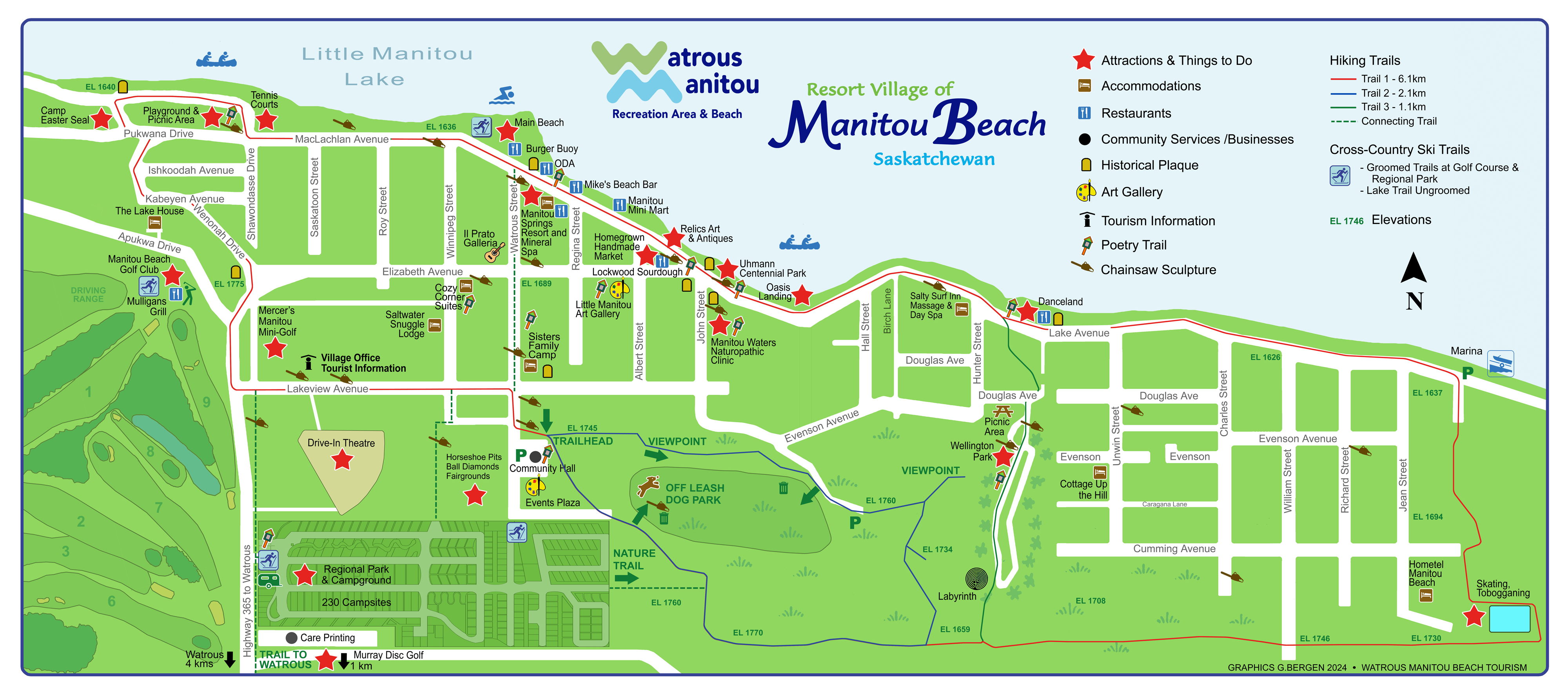
We are located 3 kms North of Watrous on Hwy #365. The GPS Location is: N51° 42.939′ W105° 27.055′ or 51.715546, -105.451064.
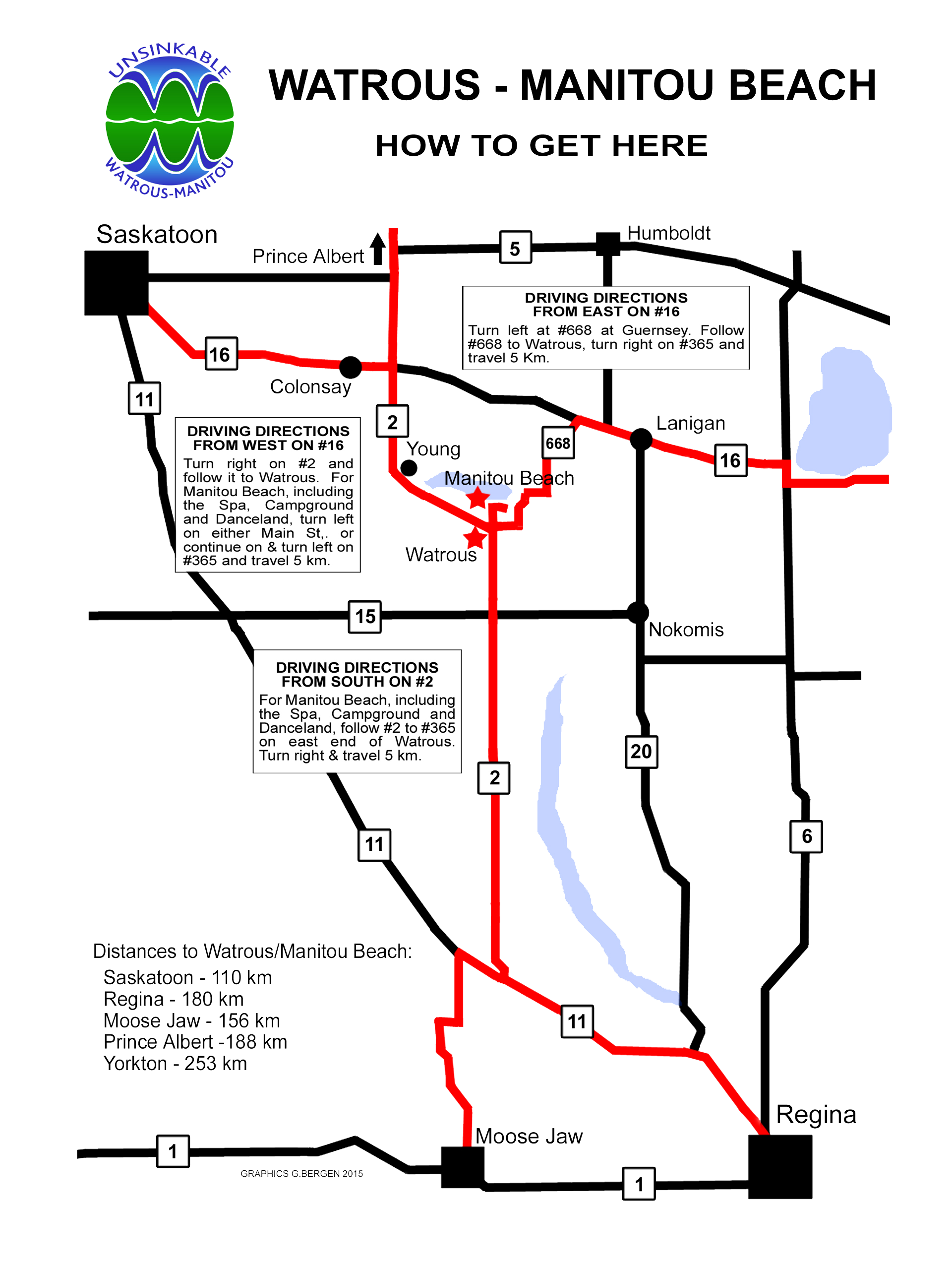
Driving Directions:
To print out a map with driving directions, click here.
From Hwy 16 East (Manitoba or Eastern SK)- Turn south on Hwy 668 for 30 km, then right on Hwy 365 for 6 km.
From Hwy 16 West (Edmonton, Alberta, Saskatoon or western Sask.) – Turn south at Hwy 2 for 60 km, turn left on Hwy 365 at Watrous for 6 km.
From Hwy 1 East (Southern Sask, Regina) – Turn NW on Hwy 11 at Regina and travel 65 km, turn north on Hwy 2 until Watrous, turn right on Hwy 365 for 8 km.
From Hwy 1 West (Calgary, Swift Current or Southern Sask) – Turn north on Hwy 2 at Moose Jaw until Watrous, turn right on Hwy 365 for 6 km.
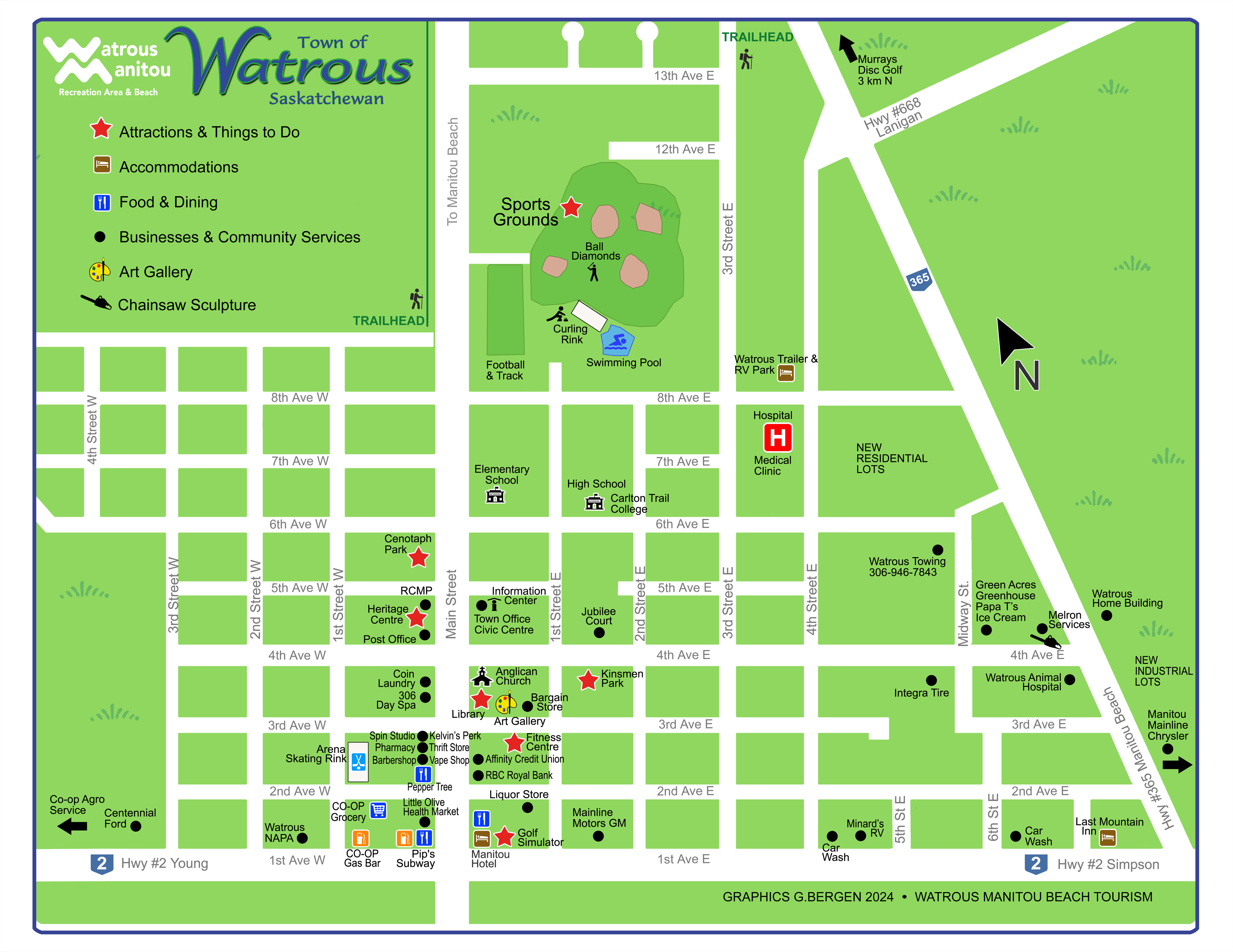
Map of Watrous (click for larger view)


